Understand the Landscape
The facts, the history, and the stakes. Everything you need to know about the proposed border wall through Big Bend.
Read the full history: The Fortress of LimestoneWhat's at Stake
The proposed wall doesn't just draw a line on a map. It may permanently alter ecosystems, cultural heritage sites, and public access to some of America's most treasured landscapes.
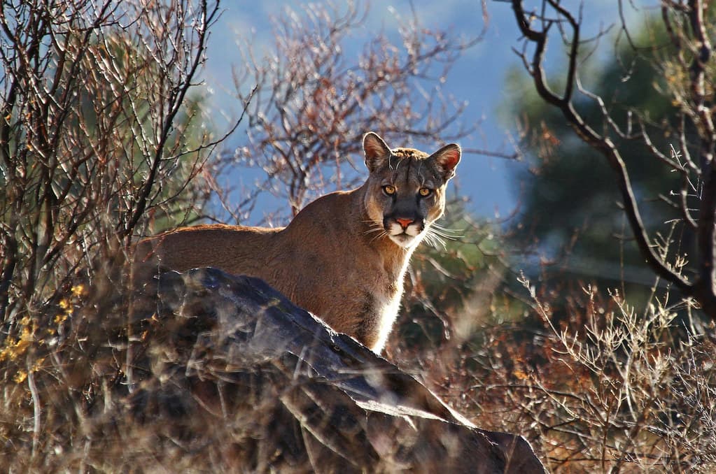
Wildlife Corridors Severed
Mountain lions, Mexican black bears, and dozens of migratory species depend on unbroken corridors across the Rio Grande. A steel bollard wall would permanently block thousands of years of natural migration routes.
Sacred Landscapes Industrialized
Santa Elena Canyon, Big Bend Hot Springs, the Hoodoos & Balanced Rock Trail — iconic landmarks that draw visitors from around the world could face closure or disruption from wall construction and access roads. No environmental impact study has been conducted thanks to the waiver of 28 federal laws.
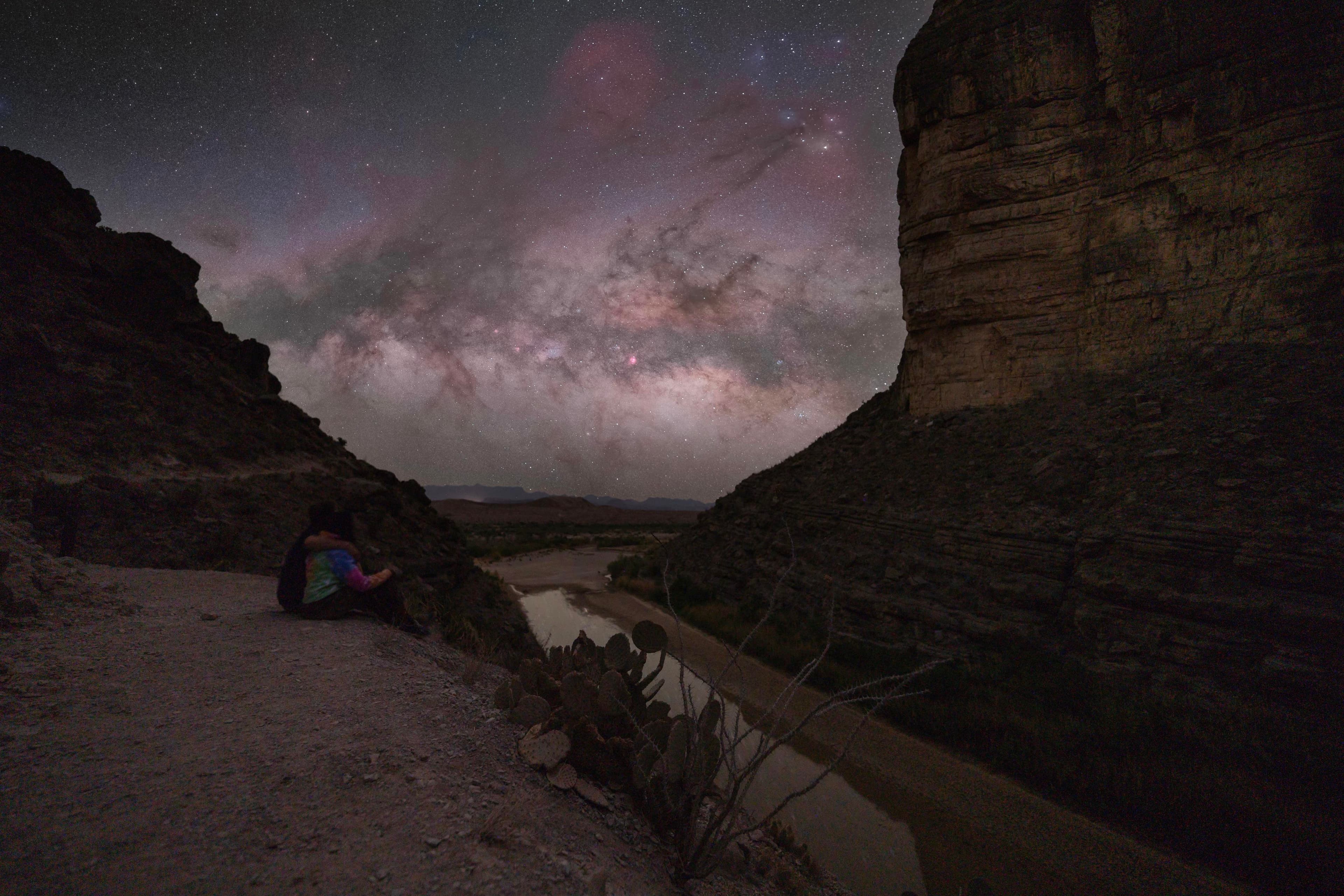
Dark Skies Under Threat
Big Bend holds an International Dark Sky Association designation. The proposed "Smart Wall" infrastructure — surveillance towers, lighting systems, and sensor arrays — would permanently degrade one of the last pristine night skies in North America.
Big Bend by the Numbers
Big Bend is one of the most remote, lowest-traffic border zones in the entire United States. These statistics, drawn from CBP data, provide context for understanding the region.
From Nearest US Town
Big Bend National Park is over 100 miles from the nearest American town. The remote terrain and harsh environment naturally limit cross-border activity in this region.
Encounters This Fiscal Year
Out of nearly 28,000 encounters logged across the entire southwest border this fiscal year, only 734 were in the Big Bend Sector — just 2.6%. Rio Grande Valley saw 5,800. El Paso saw 4,900.
Of All Southwest Border Encounters
The Big Bend Sector accounts for just 2.6% of all southwest border encounters — 734 out of nearly 28,000. The sector covers 517 miles, yet it sees far fewer encounters than Rio Grande Valley and El Paso.
Big Bend’s All-Time High (FY 2023)
The highest encounters ever recorded in the Big Bend Sector was roughly 12,000 for all of FY 2023. For comparison, other sectors have recorded that many in a single day.
The Proposed Wall Route
Compare the planned wall routes before and after CBP's March 2026 update. Drag the slider to see which segments were removed.
Orange dashed lines represent planned wall routes. Drag the slider to compare before and after.
“This landscape doesn’t need to be spoiled in order to solve a problem it doesn’t have.”
Construction Timeline
A summary of key milestones in the proposed border wall project through the Big Bend region, based on federal records.
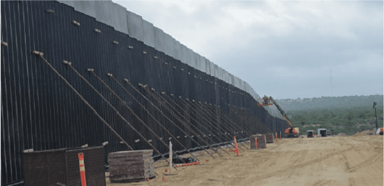
Steel bollard border wall
This is the type of 30-foot steel barrier proposed for construction through Big Bend National Park.
Photo: U.S. Customs and Border Protection
28 Federal Laws Waived
DHS publishes waivers in the Federal Register, bypassing the Wild and Scenic Rivers Act, the Endangered Species Act, the Native American Graves Protection and Repatriation Act, and 25 other environmental and cultural protection laws to expedite "Smart Wall" and physical barrier construction.
Maps Updated to "Primary Wall"
CBP updates project maps, reclassifying the Big Bend corridor from surveillance-only to "Primary Wall" — confirming steel bollard barrier construction through Big Bend National Park and Big Bend Ranch State Park.
Parsons Govt Services Awarded Contract
Parsons Government Services takes the construction contract for the "Big Bend 4" project: 112 miles from Santa Elena Canyon moving east past Rio Grande Village, plus 175 miles from Fort Quitman to Colorado Canyon.
Target Completion
Construction is slated for completion by early 2028. Environmental scientists note that impacts to ecosystems, cultural sites, dark skies, and public access may be irreversible once construction is complete.